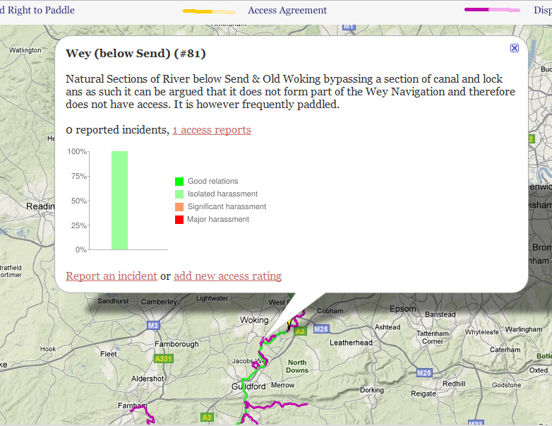
If you click on the trace of a waterway an “infobox” will appear with a summary of access information and possibly links to other authoritative sources. You will also see an indication of any reported access incidents with a link to details and a summary of users assessments of the level of harassment generally experienced on this river. Click on the link for details of individual ratings and comments.
While we hope that the map will be of use to you as an indication of where you can paddle and what reaction you can expect from other river users we also hope that you will be able to contribute to the development of the map. If you know of or paddle a river that’s not shown please add it. You can locate individual rivers / sections from a listing of all rivers in alphabetical order. This will lead to a detailed map of each river in the context of its local river system. The selected river will be indicated by an “info box” which includes links to an input form for an Access rating system. Please make your own assessment of the access situation for the waterways that you paddle and if you have experienced harassment from others in the peaceful pursuit of your pastime please report it using the “Incident Report” link.You will be able to identify exactly where the incident was, what happened and support this with photos and video clips if available.
Above all we look forward to the day when the governments in England and Wales provide confirmation of the right of access to our rivers (as already exists in Scotland). Only then will there be sufficient equity of rights and responsibilities for local parties to enter meaningful agreements to deal with specific local concerns.